Saturday, November 21, 2009

Guam, Where America's Day Begins

     Hafa adai (pronounced haaaf-a-day) and welcome to the island of Guam. As the largest island in Micronesia and the only American-held island in the region before World War II (WWII), Guam is an island in the western Pacific Ocean and is an organized, unincorporated territory of the United States. The island is the western most territory of the United States and 15 hours ahead of the Eastern Seaboard Time Zone. Hence, the popular slogan is often used: Guam, Where America's Day Begins.
     Guam is considered the hub of the western Pacific and undeniably Micronesia's most cosmopolitan destination - a true example of the great American melting pot. In addition to the indigenous Chamorros and 'stateside' Americans, Guam boasts large populations of Filipinos, Chinese, Japanese, Koreans, and Micronesian Islanders, as well as a few Vietnamese, Indians, and Europeans. The main source of income on Guam comes, first, from tourism, and second from the American military. The latter is predicted to increase by some 17 000 or more when the US-base on Okinawa closes down in the next five years.
     The picture below shows Waikiki-like beaches and upscale hotels that surround Guam’s Tumon Bay. In the distance on the top of the plateau stands the Guam airport. The big jet destined for Honolulu sits at the right end of the airport. Far off in the distance is a major hotel that is just a stone’s throw from the campus of the University of Guam.
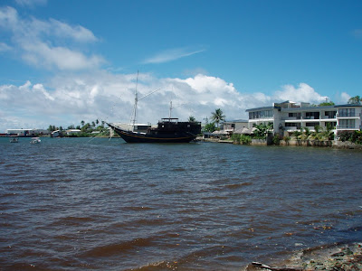
     Southern Guam is made up of volcanic hills, which rise to a maximum height of 1,334 feet above sea level. But, measured from its base at the bottom of the Marianas Trench, Mount Lamlam is the highest mountain in the world. Rivers cut through this terrain and high waterfalls abound. The central and northern sections of the island consist of a limestone plateau as high as 600 feet with steep cliffs dropping down to a narrow coastal shelf. The towering cliffs are tunneled with caves formed by the relentless and pounding surf.
     It was on a trip to the southern part of Guam that we sited the ancient Latte stones that are distinctive to Guam and the Mariana Islands.


     The Latte Stone are stone pillars of ancient houses notable for their two-piece construction; the supporting column (halagi) topped with a capstone (tasa). The "stone latte" is the signature of the Marianas Islands (Guam, Rota, Saipan, Tinian, Pagan) in that their massive size is found primarily in the Marianas.
     On a previous trip to Guam, we stopped at a replica of a traditional village, and participated in the crafts activities and the making of artifacts that were typical of local cultural practices. Below, one of the math teachers (in the blue shirt) who worked with Sandy’s projects over the years tries his hand at the making of rope done in the ancient manner.
     Another group of math teachers are shown below during a workshop on Guam. They were making models of traditional Yapese meeting houses with materials that the participants from Yap brought with them to the meeting. All are wearing Yapese lei with their distinctive red, yellow and blue coloring. The gentleman in the yellow shirt is from American Samoa, as is the woman at the opposite end of the row. The woman sitting in front is from Palau as is the man directly behind her. The white haired gentleman is from the Marshall Islands. On many occasions during the ten years of working across the Pacific, Guam was the site of the gathering of the Samoan, Marshallese, Palauan, and Micronesian mathematics teachers Sandy and Sandra came to know and cherish as dear friends.
     Like school systems on many Pacific islands, Guam’s Department of Education is suffering from severe financial constraints, some of which are due to sloppy management of US Office of Education funding. But if you go into classrooms around the island, you will find children active and happy. Indeed, if you didn’t know you were on Guam, you might think the classrooms were on Hawai‘i or Saipan. The boys shown below are busy using geo-boards to discover geometric relationships and patterns.

     Teacher salaries across the region vary widely. In Hawai‘i the starting teacher salary now exceeds $40 000 per year. Guam and Saipan salaries are have not quite reached the $40 000 threshold yet. On the FSM states, salaries might be as low as $8000 per year, and range up to around $18 000. As a point of comparison with other states and territories, the Governors of the FSM states have salaries in the $25 000 to $35 000 range.
     Yet expenses on these islands are as high if not higher than on Hawai‘i or the mainland. Gas on the Marshall Islands was $5.00 per gallon, the same on Kosrae, and on each of those islands there was one or at most two gas stations. On Kosrae, the station was only open 5 hours each weekday, and closed on the weekends. On Pohnpei gas dropped to $3.90 per gallon with lots of gas stations, but on Chuuk it was back up to $5.00 with just one station operational. Guam, Saipan and Palau were all about the same, $3.75 per gallon with lots of stations. On Yap, the price was $9.00 per gallon if the rental car was returned with less than a full tank, which could only be filled at one station that opened for only 4 hours per day.
     But what the islands of the Pacific may experience in terms of financial challenges, they more than make up in terms of beauty, none more so than the splendid and dynamic sunsets one witnesses on small, remote Pacific islands. The picture below is just one example of such a sunset that we took while sitting on the lanai bar of our hotel on Guam.
     As we prepared to fly out of Guam, heading home to Honolulu, we experienced ‘chicken skin’ at the many wonderful memories we have of Micronesian people smiling broadly and exclaiming excitedly as they tried on the readings glasses we shared across the islands. Our very appearance at the arrival gate of many FSM airports signaled the ‘coconut telegraph’ to go into high gear: “the Dawsons have come, and they have glasses”. The PREL service center offices would receive phone calls inquiring about the glasses long before we had been able to drive from the airport to the office. Even when departing some of the islands, the security people who manually go through all the luggage would quietly ask, when they got to the suitcase full of glasses, if they could have a pair of glasses for their mom, or their grandma, or their auntie, or their uncle, hardly ever for themselves, even though some of those agents were squinting to read our names in our passports. Those of you who contributed to the collection of glasses we carried with us should feel justifiably happy about the joy and pleasure your contributions brought to peoples all across the Pacific. In particular, Lannie Kanevsky from Vancouver, Canada found 1200 pairs of reading glasses for sale on eBAy, purchased them, and sent them to us for sharing across Micronesia. Mahalo plenty, Lannie.
     The sharing of the 1200+ pairs of glasses took place during the past year, not just by us, but also by PREL employees who transported the glasses in their suitcases as they headed west across the Pacific.
     And so ends our travels across Micronesia: traversing five time zones as well as a day change in the space of 36 hours will no doubt have its effects on our aging bodies, but, you know, we don’t mind that part at all because the pleasure we get from our associations with all those wonderful Micronesian people. That is well worth a bit of lost sleep and tired bodies.
     By the way, the purpose of the trip--to identify a set of folks to work on the new Macimise Project--was a huge success. Indeed, there are more applicants than there are spaces available with the Project. Such interest bodes well for the future of maths education on the Micronesian Islands as the Project should produce university graduates with Masters Degrees (10-12) and Doctorates (8-10).
     Aloha and Mahalo till next time…Sandra & Sandy

Saipan and the Commonweath of the Northern Mariana Islands


Guam and Saipan, CNMI lay within the new Mariana Trench, Pacific Remote Islands and Rose Atoll Marine National Monument Park that was created earlier this year. The area encompasses 195,280 square miles of high seas that will be barred from fishing, mining and other uses. The Mariana Trench is the deepest known part of the world’s ocean, and the lowest elevation of the surface of the Earth.


Unlike the Federated States of Micronesia, or the Republics of Palau and the Marshall Islands, Guam and CNMI are not islands independent of the United States. Guam is a US territory and CNMI is a Commonwealth. And like Hawai‘i’s Waikiki beach, Guam and Saipan each have their own string of large hotels, shopping malls, internationally franchised restaurants, (e.g., Outback Steakhouse, Tony Roma’s, etc.). Some say that Guam’s Tumon Bay area is trying to be a little Waikiki, and Saipan’s Micro Beach area is trying to be a little Tumon Bay! Both islands are commercialized, dotted with suburban developments that seem to emerge overnight out of the jungles. They are much more like Hawai‘i than they are the Marshall Islands, or the FSM, or Palau.
We flew from Yap to Saipan with a change of planes on Guam, where we had time for a hot latté and sticky bun in the departure area of the Guam airport that thrives from 5 am to 8 am every morning, probably its busiest time of the day. The flight from Guam to Saipan is a short one, 45 minutes, but the plane passes over the small but historic island of Tinian. It was from Tinian that the B-29 Super Fortress bombers were launched that dropped the atom bombs on Japan at the end of the Second World War. The picture below shows the runway on Tinian, now unused, but nevertheless a reminder of more violent times in this region of the Pacific.
We landed on Saipan at 8 am, pretty beat after what seemed like an all night trip from Yap. We headed for the hotel we’ve stayed at many times, a suite hotel on the beach. That’s Sandra taking a short stroll on the beach prior to us crashing for 4 hours before we had to be at our afternoon meeting with the school superintendent and her staff.
Not being able to sleep very well, we were up in plenty of time to have lunch—a new Vietnamese restaurant that was great where Sandy had his usual pork chops—so decided to take a drive to the north end of the island. There we saw once again, as we have a few times before, the majestic and spiritual Suicide Cliffs, the site of a massive suicide by Japanese families at the conclusion of the Allied invasion of Saipan. The picture below is of the cliffs.

Though the Allied forces attempted to tell, by dropping leaflets over the island, the Japanese residents they would not be harmed, these peoples had been convinced that they would be subjected to severe torture and killings. Acting honorably by Japanese tradition and teachings, they decided to jump ‘in mass’ from Suicide Cliff. Some 5000 people died in one day! Since the war, many countries, including Japan, Korea, the USA, among others, have created memorials at the base of the cliffs to honor those who lost their lives that day. Some of the memorials are shown below along the ridge of Banzai Peace Memorial Cliff, which is a flat area of land below Suicide Cliff, but which itself is on the edge of the ocean. For those interested, James Bradley has written a compelling description of the end of WWII in the Western Pacific including the battle on Palau at Peleliu and the taking of Saipan island. The book titled, Flyboys, explains the mind-set of the Japanese people on Saipan that led to their mass suicide.
Then it was time to head for our meeting with the school folks. Education on Saipan is thriving even though under severe economic constraints. The leadership of the system is dynamic and forward looking, and makes use of the skills and experiences of school personnel to guide the system forward. One small example of such leadership can be found in the high school on the southern end of Saipan that includes art studios with 4 kilns, a full band room for its orchestra that has played internationally, and of course Sandy’s favorite, the math classroom equipped with computers that are using the latest software to teach geometry—see below.

The teacher in the picture was the school principal, but he is now an Assistant Superintendent of the entire system brought to the central office to make use of his creative talents by applying those to schools island wide.
At the end of this long day, we flew back to Guam where we stayed over night prior to taking the 7 am flight to Honolulu, a seven and a half hour trip to the east that crosses 4 time zones and the International Date Line. We left Guam on Saturday morning, and got to Honolulu, Friday evening of the day before! Oh well, that means we get to sleep through two Friday nights in one week!
But before we could take that flight, we must talk about Guam since we had previously spent a full day there as we passed from Chuuk through to Palau. So we thought we’d end this Blog with our impressions and experiences of Guam.
Postscript: Subsequent to the preparation and placing of this posting on the Blog, a lone gunman on Saipan killed four people including two children in a seemingly random act of violence. The shooter then drove to the Banzai Peace Memorial where he fatally shot himself.


Sunday, November 15, 2009

Yap—the land of Stone Money


Yap, the fourth FSM State, is comprised of the main island of Yap, and the three prominent outer islands of Satawal, Ulithi, and Woleai. It is the most westward of the FSM States, with Chuuk, Pohnpei, and Kosrae lying east of Yap towards Hawai‘i, as can be seen on the map above (click on the map to expand it). Yap state stretches across some 1 200 km of ocean and is dotted with upwards of 130 small, low-lying atolls. Though spread across a vast expense of ocean, in terms of landmass it is only about 120 km2. The small town of Colonia, the capital and commercial center of the state, is situated along the waterfront and around Chamorro bay on the island of Yap. English is the language of business, but Yapese, Satawalese, Ulithian, and Woleaian are all functioning mother tongues of the state. The people of Yap expend great efforts to preserve their languages, traditional forms of dress, and cultural activities that have passed from generation to generation.

Many Yapese still wear traditional attire o f loincloth or ‘thu’ for the men, and ‘grass skirts’ or lava lavas for women. A man’s ‘thu’ is made of red, white, or blue cloth, and adult men may add a traditional woven ‘bagi’ and hibiscus fibers. The ‘elder’ below was a Harvard graduate who was the spokesman when his village entertained visitors.

The women’s grass skirts are not made of grass, but of shredded leaves of ti, banana, betelnut, fragrant ginger, fern and other leaves. The women shown below, members of the elder’s village, are busy doing typical Yapese arts and crafts: basket weaving and lei making. The women are wearing traditional skirts. It takes many weeks to make each skirt because of the coloring (dyeing) of the leaves.

The village puts on displays of Yapese stick dancing to supplement the communities' income from the sale of their crafts and vegetables. The two film clips below are recordings of the village dancers. The dance took place just after a very heavy downpour of rain. They were supposed to dance on the path next to the large pieces of stone money that can be seen behind the dancers, but when the water rose to a level of six inches the dance was moved up onto the platform in front of the meeting house, and then continued during the next downpour of rain. The chanter is the older woman that you can catch glimpses of behind the dancers.

The picture below juxtaposes the two elements of Yapese society: the men dressed in traditional ‘thu’, betelnut bags under their arms, stopping to chat with a friend who was driving by on the main road in his new car.

Yap is probably best known for stone money—huge disks of crystalline stone, quarried on Palau and carried to Yap a century or more ago on open, ocean going canoes. The value of a piece of stone money is partially determined by its size, but also by the number of lives that were lost in bringing the stone money to Yap from Palau. The stone disks measure up to seven feet in diameter and weigh as much as four tons, making them the world’s largest currency. The stone money discs in the picture below are on the small side. The tree on the left that has white rings around it is a betelnut true, the source of the infamous betelnut that Yapese chew with great gusto!

A major part of the appeal of Yap is that it maintains many of its traditional characteristics. Stone paths wind through food producing landscapes of tree gardens and taro patch systems. Permission to walk on these paths should always be sought from someone in the village that owns the land.

Many come to Yap for the diving, especially the chance to glimpse the sight of one of the many manta rays gliding over the cleaning stations. The rays can reach a size of 15 feet across, and local divers have catalogued upwards of the 100 manta rays that cruise the waters around the Yap lagoon. The picture below is of the Manta Ray Bay (MRB) hotel from whence the largest number of diving expeditions sets forth. The old galleon was rescued by the owner of the MRB and turned into the hotel's restaurant. On Fridays, late afternoon-early evening, a movie screen is erected on the mast, and local teenagers are invited for a soft drink and movie night. It is great fun and the teens certainly seem to enjoy the chance to mingle socially outside of a school or village setting.

The voyage of the Hokule‘a from Hawai‘i in 2007 brought home to Satawal, one of Yap’s outer islands, a twin canoe, the Maisu, honoring the traditional navigator who led a revival of the ancient forms of Polynesian celestial navigation. Satawal is a low lying atoll that did not have secure moorage for the Maisu so it was then sailed to Yap where it is currently being used to teach a new generation of navigators. The picture below is of the Maisu docked in the harbor on Yap.

The Yapese, like the Palauans, carve storyboards and idols. The ‘Monkey Man’ is common to both islands, and one was pictured on the Palauan Blog. Early visitors to the Islands dubbed the Lios, or ‘spirit image’ from the island of Ulithi, an outer atoll of Yap, the “Monkey Man”. It is a protective spirit, most likely an ancestral image whose function it was to protect the family or relatives of the deceased. The function of such household spirits could change with context and this Lios might also be a guardian of dwellings or of spirit houses. Of the many types of Lios found in Micronesia, the so-called Monkey Man, carved from indigenous wood, is one of the most enduring. The picture below is of a Yapese Monkey Man that Sandra purchased, this time on Yap, a ‘brother’ for the one she purchased on Palau.

During a typhoon a couple of years ago, 80% of the schools were blown away; they just disappeared as if they never existed. Today the schools have been rebuilt and though supplies are in short supply the schools function well. Teachers are supported and children are energetic and happy attendees. Though the Yapese culture is hierarchal, in school children interact openly even if later on the playground children from a higher tribe might not speak with children of a lower tribe. In a similar fashion, children are not encouraged to ask question in social situations outside of the family, and so always speak softly when spoken to by adults. In school, they certainly ask questions and get quite verbally energetic. This is behavior most pronounced on Yap, but is characteristic of Micronesian children from other islands. When Micronesian children move to Hawai‘i or the mainland, they often display their ‘out of school’ behavior, that is, not speaking in front of adults, or speaking very softly when spoken to, and almost never asking questions. Mainland and Hawaiian teachers are well served if they recognize these behavior patterns, understand from whence they emanate, and gradually work with Micronesian children so they adopt more of the school behavior they experienced on their home islands.

So we now say ‘kamagar’ (thank you) to our Yapese friends, pack our bags for the second last time, get our weary bodies ready for the 4 am departure, and look forward to our time on the lands of the Chamorro people on Saipan and Guam.

Saturday, November 14, 2009

Palau—a nation on the move


“Alii” (pronounced ‘a lee’) and welcome to Koror, the Republic of Palau’s gateway to other islands in this 325-mile long archipelago. Located between Palau’s ‘big island’ of Babeldaob and the tiny Rock Islands, Koror, 3.5 miles long, is a bustling business center. Of all the Micronesia islands visited thus far, Palau is the only one that has what could reasonably be called a little city atmosphere. The main street of Koror is lined with in excess of 25 restaurants, where local fish dishes are favorites, small stores, gas stations that are actually open and operational, small-medium-and large American style hotels, and the ubiquitous massage parlors. Palau is famous for carved wooden storyboards recounting ancient legends, and fine pandanus weavings. See the picture below of Sandra’s most recent purchases of storyboards—with the Monkey Man in the middle—carved by the prisoners resident in Palau’s gaol.

Placed like gems in a cobalt sea, more than 426 Rock islands lie in a 23-mile long lagoon between Koror and Peleliu. Remnants of ancient uplifted coral reefs, undercut by the persistent action of waves, and draped with dark greenhouse foliage, the Rock Islands are Palau’s premier visitor attraction. Beneath the surface of the sea dazzling coral gardens teem with iridescent fish, and underwater cliffs drop thousands of feet in the horizontal distance of a few paces. The picture below shows about 70 of the 426 Rock islands.

Palau is considered to be one of the prime diving sites in the entire world. Across Micronesia, however, Yap and Chuuk are rivals for that claim. Yap is home to the manta rays, and Chuuk has the remainder of the Japanese fleet in the bottom of its lagoon. Divers can’t go far wrong if they include all three sites on their trip to the Western Pacific.

Babeldaob is Palau’s version of Hawai‘i’s ‘big island’. Babeldaob is a land of fertile volcanic hills criss-crossed with rivers. The second largest landmass in Micronesia after Guam, Babeldaob is 27 miles long and 15 miles across. In 2006, the new national Capitol was officially opened in Melekeok State. Access to the capitol and much of Babeldaob is now possible via the road paid for through the US-Palau Compact Agreement. The new national Capitol rivals Washington DC in terms of the size and grandeur of the Legislative, Judicial, and Executive wings of the Capitol buildings.

The main road in Koror and all the way to the State capital is wide, smooth, and newly built. After the driving experience on Chuuk, it was certainly as pleasure to navigate along Palau’s modern, well-drained highway.

A trip to Palau wouldn’t be complete for us without a trip to the ocean-side bar where the film crew from the TV reality show “Survivor Palau” went after a day of filming, and where the crew of the Hokule‘u mounted the giant oar from their canoe at the conclusion of the westward leg of their trip across the Pacific. In the picture below, the banner of the TV show can be seen above Sandra’s head, and the long handle of the oar is lashed to the rafter, perpendicular to and just to the left of the banner.

Education on Palau is a thriving venture. Though schools look much the same as the ones on Chuuk, Palauan schools are better equipped and the teachers receive lots of training and support from the local board of education. The buildings are open on both sides of the classroom, and the children wear uniforms much like schools across all of Micronesia.

G. B. Harris, the school pictured above is on Koror. The school pictured below is on the island of Peleliu. As can be seen in the photograph, the school was built in 1945. It is said construction began the day World War II ended. The people of Peleliu were motivated to quickly rebuild their island which was the site of one of the most devastating battles of WWII, one in which 30 000 soldiers lost their lives, 25 000 Japanese and 5 000 Allied troops.

The people started the rebuilding process with the school, and today it is a modern symbol of the prominence that Palauans give to education. The grade four children in the picture below are doing arithmetic. The class was well equipped, materials were plentiful, and the children were engaged and enthusiastic about their work.

Sleepy eyed we said ‘sulang’ to the independent Republic of Palau as we boarded the 1 am flight bound for Yap, a 45 minute short hop to the fourth and final FSM state on our trip. Getting from Palau or Yap back to Guam is an energy sapping experience. The only flights are at 1 am out of Palau, for the 45 minutes flight to Yap. Then around 3:30 am, the flight continues from Yap onto Guam arriving there at 5:00 am. The schedule is this way in order to accommodate Palaun and Yapesse people to catch a connecting flight to Honolulu that departs from Guam at 7 am. By arranging the schedule in that way, people on these two remote islands do not have to spend money on a hotel on Guam waiting for the early morning flight to Hawai‘i. It all makes sense, but it sure plays hell with one's body!


Thursday, November 12, 2009

Chuuk—an island in disarray


The greeting of ‘Ran Annim’ signals that we have landed on Chuuk, the FSM state with the largest population (53 000) even though its main commercial and governmental center, Weno Island, numbers just 15 000 people. Chuuk state is composed of 11 high mangrove-fringed islands inside the Chuuk lagoon that is home to the other 43 000 people not living on Weno. There are 14 outlying atolls and low islands surrounding the lagoon. The picture below is of Weno Island showing the main business area along the coast of the island.

After landing we drove to our hotel, the Truk Stop, over a road that is 95% potholes, and 5% pavement. The 1.5-mile drive took us 25 minutes, as some of the potholes were the size of a swimming pool, not quite as deep, but certainly filled with water. There are very few car accidents on Chuuk because one cannot drive much faster than 5 mph. Mind you some cars have been known to be lost in the most severe potholes. Where’s Honolulu’s mayor, dear Mufi, when you need someone to fix potholes? That is Chuuk’s main road in the picture below.

The lagoon, still referred to as the ‘Truk Lagoon’ is one of the largest enclosed lagoons in the world, circled by a 225 km long barrier reef, and covering an area of 2 129 km2. The Truk Lagoon is home to more than 100 World War II Japanese ships and planes, sunk during an unanticipated (by the Japanese military) attack on the fleet anchored in the lagoon. Divers from all over the world come to marvel at this underwater museum. The waters are relatively shallow, and the wrecks have become beautiful living reefs of brilliant soft coral.

The glasses donated to us by so many are truly appreciated whichever island we happen to be on. The picture below shows some Chuukese folks selecting glasses from the large collection of glasses we carried on this trip, some 400+ glasses in total. By the time we made the trip from the Chuuk airport to our hotel, the PREL office next door to the hotel and from where the glasses would be distributed was already receiving phones calls asking Sandra & Sandy had brought glasses with them, and if so could the person come to the PREL office immediately to pick out a pair? Our arrival on the islands seems to signal that glasses will be available and word passes quickly along the 'coconut express'.

Chuukese children are wonderfully open and joyful kids who have learnt to accommodate to whatever circumstances they find in their schools. Sandy has been associated with Iras School (shown in the picture below) for a number of years. The school has no AC, both sides of the building are open, and the school is downwind from a pig farm.

One day he observed a Chuukese teacher offering a lesson on fractions to 45 children who were sitting on the floor (there were no desks or chairs) arranged in 5 rows of 9, each child attentively and quietly sitting on her/his 18 inch square floor space, totally engaged in the lesson. The teacher had no chalkboard or chalk, or a whiteboard, nothing to write on, yet the lesson went smoothly and when the teacher did a short quiz at the end to see if the children could add simple fractions they all could do so. It was amazing to watch this teacher—he was animated, funny, and had the total attention of every child in the class, and the children learnt.

On another occasion, the principal of Iras School challenged Sandy to teach some math to a group of parents, this in response to Sandy encouraging the teachers to try some different ways to teach mathematics—a kind of ‘put up or shut up’ challenge to the ‘professor’. So the next morning the call went out over the only radio station on island that a parents’ meeting would be held at Iras school that afternoon at 1:30 pm, right after school was dismissed early for the day. The girls in the picture below taken a few years ago were on their way home from school because ‘Sandy was going to teach their parents’!

Sixty parents showed up, the vast majority were women, and most did not have any schooling beyond the eighth grade. Sandy’s good friend (the late Martin Wierlangt), a Pohnpeian who spoke fluent Chuukese, acted as translator. From out of somewhere, about two-dozen chairs appeared, and a couple of blackboards and 4 pieces of chalk materialized. The blackboards were propped against the wall and the ‘lesson’ began. For an hour and a half the women laughed and encouraged each other as they ‘did math’. Sandy gave a few directions, Martin translated, and the women went to work. And they learnt some math, they discovered some patterns, they solved some puzzles. The afternoon was a huge success and these parents went away knowing a little bit of the math their children were learning in Iras school. It was not due to Sandy’s teaching—it was due to being given activities and approaches in which they could use their native intelligence to solve the problems, all based on the conviction that these people too could do mathematics.

Teachers in Hawai‘i have difficulties getting the parents of Micronesian children to take part in parent-teacher interviews, or school activities, to even get the parents to set foot in the school. They need to realize that typical Micronesian parents revere schools and teachers, and feel it is not the parents right to ‘interfere’ with the teacher or the school. Moreover, in some cases the parents are embarrassed about their own lack of education, and there own struggles with the English language. It is not because the parents don’t care, or that they can’t learn as the above experience on Chuuk demonstrated. Perhaps teachers could have parents come to an event that is conducted in the parents’ own language, engage the parents in a meaningful activity, and see if such an activity opens a pathway for the teachers and parents to communicate.

Though there are several ‘larger’ stores on Weno, much of the everyday shopping on Chuuk takes place in small roadside storefronts—small ‘Mom & Pop’ stores as shown below.

The ice chests contain cold drinks, typically stale dated ones shipped in by the bottling companies who distribute their unsold stock to these isolated Micronesian islands. The fruits and vegetables would be home grown. Local woman who earn a small income from the sale of the clothes would have made the skirts and blouses shown below.

There are taxis that travel the main road on Chuuk as well as a couple of the roads that lead up the side hills that overlook the town. The taxis cost about $.50 for a one-way ride. However, the primary mode of transportation in and around the lagoon is by water taxis. A caravan of boats, each powered by a 50 horsepower engine, usually filled with adults and children, speed into Weno from the lagoon islands in the morning carrying people to their jobs and kids to school, and then out again in late afternoon after school is out and stores close up. One such boat is shown below. Imagine 30 or 40 such boats, following closely one another stretching out across the waters of the lagoon, and you have an idea of the water taxi experience on Chuuk. The shortest ride would be some 45 minutes, and some lagoon islands are as much as two hours away. Now that is a ‘commute’ to match anything on Hawai‘i or the mainland made all the more challenging when it is raining or the seas are rolling!

On Chuuk, as in many jurisdictions around the world, politics plays a critical role in determining who has jobs, who gets promoted, what gets done, and so on. The situation on Chuuk, however, seems particularly acute as public monies never seem be used for the projects and programs they were intended to serve. The school system is in disarray with the Governor ignoring the legally elected school board leading to an impasse that is destroying morale among teachers and administrators. Teachers who supported the unsuccessful candidate during the recent gubernatorial elections are being banished to outer islands in the lagoon, forcing them to leave their families behind on Weno. Still the school children are eager to learn and willing to work towards a better life on Chuuk. Some teachers and administrators work very hard to provide the best education they can under incredibly challenging circumstances.

But it is time to leave these loving and caring Chuukese and move west ward. So with a wave and hearty ‘Kinosou’ (thank you), we struggle along that main road one last time on the drive to the airport. This time a large tank truck led us through the pot holes showing us how to avoid the very worst water-filled caverns on the road.

From Chuuk we flew to Guam thus completing the final leg of the Island Hopper journey. We spent one day on Guam before flying to Palau. We will talk about Guam combining our description of it with that of Saipan, the two countries with a Chamorro language base. The next posting will be about Palau, a crown jewel of the diving world, and the country that is the western extreme of our trip across Micronesia.

Thursday, November 5, 2009

Two of the FSM States


When we last wrote we were leaving Kwaj on our way to Kosrae, the first of four Federated States of Micronesia (FSM) that we visit on this trip. The other states of the FSM are Pohnpei, Chuuk, and Yap. This posting talks about Kosrae, and then Pohnpei.

Tu wo—hello in Kosraean, at least that’s what you say in the morning. In the afternoon, you would say, Len wo, and in the evening something different again.

The island of Kosrae is very different from the atolls of the Marshall Islands. The picture above was taken as we approached Kosrae. It is lush and green no doubt due to the at times never- ending rains during the winter months. Indeed, during the almost three days we spent there, it rained heavily for all but the first afternoon. Kosrae is known as the home of the Sleeping Lady. Can you see the Sleeping Lady below in another somewhat fuzzy picture of Kosrae? It is difficult to take these pictures from a plane flying at high speed!

Kosrae is a 109 km2 (42 miles2) island surrounded by a reef. It is circular in shape, measuring only 16 km (10 miles) across at it widest point. The single island that makes up Kosrae is a dense jungle mountainous island with lush green interior and several white coral beaches.

Whereas the road on Majuro ran down the middle of the atoll, Kosrae’s one road hugs the ocean shore. The road is paved and smooth its entire length, but it doesn’t go all around the entire island, only from the airport near the village of Tafunsak through to the village of Utwe, the five western coastal villages. After Utwe there is a rough gravel road that goes a bit further around the island, but then one must journey by boat the remaining distance to circumnavigate the entire island.

Kosrae is very small, both in physical size and population-wise. It has just over 8 000 people, and the elementary school-aged children go to one of six public schools on island. There are also a couple of small, private schools mostly with connections to the one church or another. There is one central high school in Tofol, the state capital, that will be housed in a new, huge three-story structure. Why such a large school is being built is one of the many mysteries of these Micronesian islands. The reason it seems, though no one said this out loud, is that the money provided for a new high school was sufficient to build such a massive structure so that is what is happening. Some Kosraeans I spoke to about it just shook their heads and shrugged their shoulders as only Micronesians can do.

The changes that have occurred on Kosrae in the ten years we’ve been going there are impressive. The first change that we noticed was the condition of the airport fire engine that sits by the runway for every landing. Ten years ago there was a single, old red fire truck parked by the runway. It had two flat tires, one wooden ladder, and we were told that pumper on the truck didn’t work! Now each of the FSM states has a state-of-the-art, enormous yellow fire truck, sometimes two of them. The one on Pohnpei, that is the same as the one on Kosrae, is shown in a picture at the end of this posting.

The second change is the fact that the road is paved, something that still has not occurred on Chuuk, but that is a story for a later posting. And Kosrae is a very clean island— many of the old rusting cars have been cleared away, there is regular garbage pick-up service, and the people take pride in keeping the main road clean and tidy.

Perhaps the largest change, however, is Kosrae’s access to the world, and the world’s impact on Kosrae through television and the Internet. Ten years ago neither technology was available. Even phone service was spasmodic. Today cell phones are ubiquitous, the Internet is widely available, and television programming is only a week behind the mainland. The afternoon we arrived on Kosrae, I taught (with much help from Joe Zilliox) my graduate course sitting in a gazebo by the ocean shore just across the road from our hotel. It was a wireless connection, very strong, that was used by all Kosraeans who had portable computers. We would see cars/trucks parked in the evening along the road near the gazebo with people sitting with computers on their laps accessing the Internet. Some were even sitting in the back of their pickups.

The hotel owner had situated his hotspot so that it sent a strong signal towards the gazebo area so that all people on the island could make use of it. We were going to get some pictures the following day of all that activity, but then the rains came and we didn’t get out of the hotel for almost two full days.

We mentioned before that Sandy’s suitcase didn’t make it to Kosrae. His baggage tag was put on another man’s bag and that’s what arrived. So Continental Airlines said they’d get Sandy's bag from Kwaj and bring it over on the next flight, two days hence. They gave him a $50 voucher to buy a few clothes, and provided a complimentary Continental toiletry kit. There’s really only one small store on Kosrae so Sandy had a very difficult time finding a pair of shorts and a couple of tee shirts that would fit him. We decided there are no ‘big’ Kosraean men, or if there are they had bought up all the Sandy-sized clothes. There are definitely no pictures included here of Sandy in his ‘make-do’ Kosraean shorts and tee shirts.

As well as preventing us from getting many pictures, the heavy rains washed out the big sports day during the Friday we were on Kosrae. Sports are a huge part of Kosrean life, so the rain storm caused great disappointment among adults and children.

When we woke Saturday, it was still raining but regardless we headed off to the airport the required three hours ahead of the scheduled departure. That amount of time is needed because every, and I mean every, piece of luggage is inspected by hand. Typically, the entire contents of one’s bag are put out on the table and then repacked by the inspector! It takes a long time to check in 40 people for one flight. And then you wait for the plane to arrive. On this particular day, we waited and waited and waited only to be told five hours after we got to the airport that the plane had broken down on Kwaj. It was announced that a ‘rescue’ plane would be sent from Guam and we could expect to be picked up in about 5 hours. True to their word, that’s what happened so we were ten hours late getting to Pohnpei, and it was some 14 hours since we stood in line to check in for the flight. So ‘kulo’ (thank you) to my Kosraean friends for their hospitality during our wet 2 plus days on your island.

BUT, Sandy’s suitcase was on the rescue plane so come good came out of the day. He could put his Kosraean clothes permanently to rest! We went to sleep on Pohnpei secure in the knowledge that when we woke the sun would be shining brightly, and we’d have a wonderful view of Sokehs rock that stands at the entrance to the Pohnpei harbor (see picture below).

Kaselehlie (hello, said with a slight bow of the head), and welcome to Pohnpei, the largest island in the FSM at 334 km2 (129 miles2) that boasts a towering, rugged interior and is of volcanic origin. The island is a deeply indented, jagged circle, some 21 km (13 miles) in diameter, and some 112 km (70 miles) in circumference. The main island is ringed by 25 smaller widely scattered coral atolls, one of which is Pingelap, an atoll that Sandy’s students know well from taking an imaginary trip there to learn to count as the Pingelapese would. If you’d like to read about Pingelap search out the book by Oliver Sacks titled The Island of the Colorblind. The picture below shows the road on Pohnpei where many of the Pingelapese migrate to from their home atoll.

Pohnpei’s population of around 34 000 lives mostly on the main island and are engaged in subsistence agriculture and a variety of small farms and handicraft industries. Pohnpeian pepper, though expensive, is regarded as the finest in the world. The island abounds in tropical forests, cascading mountain streams, hidden pools, and exquisite flora.

Most interesting and astonishing of all Pohnpei’s many sites are the ruins of Nan Madol, an ancient Venice-like city, the construction of which commenced around 500 AD and some buildings have been dated to as recently as 1,500 AD. We didn’t go to Nan Madol on this trip but have been there several times on previous occasions. It is truly a remarkable place, amazing in that it was constructed using hexagon, stone logs of basalt, each weighing several tons. The walls of the city rise as high as 12 meters and are up to 5 meters thick. Nan Madol was the governing center of Pohnpei till about 1650. The picture below was taken on a previous trip to Nan Madol and shows the massive corner of one of the remaining buildings.

Elementary schools are scattered about the island with the primary high school, PICS, being located in the center of the main town of Kolonia. The schools are modern and relatively well equipped. The vast majority of elementary teachers have two-year associate degrees from the local community college. In recent years, elementary teachers who somehow manage to complete their bachelors’ degree are assigned to teach in the high school, because it is felt that the best educated teachers should work with high school students in order to improve the chances of the students graduating from high school.

But now we have to board the Island Hopper once again to jump over to the next FSM state, namely Chuuk. As we leave Pohnpei with a heart felt Kalahngan (thank you), we see one of those brand new yellow fire trucks that situate themselves at the end of the runway for each take off and landing. The fact that the runways in the FSM are notoriously short--the pilot has to 'hit' the first white mark on the runway, or s/he will never get the plane stopped before it falls off the far end of the runway. Maybe it is a good thing those fire trucks are there!

See you next when we recount the tumultuous days we spent on Chuuk, trying to navigate what to us are the worst roads we've ever seen anywhere in the world! On the other hand, the Chuukese people are some of the friendliness we've ever met.

Thursday, October 29, 2009

Majuro, the Marshall Islands


Iakwe (pronounced ‘Yak Way’ which means hello).

Majuro, the capital of the Marshall Islands was first stop on our trip across the Pacific. That is downtown Majuro at the extreme right of the atoll (pronounced as if saying ‘a tall’ man) pictured below.

Atolls are the remnants of long dormant volcanoes that have sunk into the ocean. The atoll on which Majuro is located is 30 miles (50 km) long and about 300 yards (275 meters) at its widest point. The elevation of the Majuro atoll is about 3 feet, a little less than one meter. The highest point on the atoll, on the top of a small bridge (shown below), which joins a break in the atoll, is thirteen feet (4 meters). Needless to say, storms with strong winds send waves clear across the island destroying any of the ramshackle structures that dot the atoll.

Island schools range from the recent modern facilities constructed in the last 5 years and some that are in danger of being washed away during a violent storm.

Marshallese children attending the schools look much like kids on Hawai‘i or the mainland, wearing school uniforms that are distinctive for each school. The girls shown below are from two different schools located on the same school grounds. One girl is from the high school pictured above, and the other student is from the middle school that can be seen behind the girls.

There are similarities among life on Majuro and life on other Micronesia islands. Typically, these islands have one main road that on Majuro runs the length of the atoll. On the widest part of the atoll there is a second road, mainly residential, that parallels the main road.

The islands have a wonderful sense of whimsy that sees stores such KLG instead of KFC as shown in the picture below. Probably half of the vehicles on Majuro are right hand drives as can be seen in the KLG photograph. The reason for the right hand drive vehicles is that importing from Australia or Japan is much cheaper than getting cars from mainland USA.

Schooling on Majuro suffers from a decline in education system that occurred after the Second World War. New efforts are being made to bring the Marshallese culture to a more prominent place in the school curriculum so that children can build on everyday life experiences for their understanding of school subjects. Mainland math textbooks that ask children to say how many snowmen are in the playground if the girls build three and the boys build four do not have any meaning for the children of the Pacific, yet that is the type of mathematics that gained hold in the islands as part of the Americanization of the school curriculum over the last 60 years.

The Macimise (Mathematics And Culture In Micronesia: Integrating Societal Experiences) Project is designed to enable local informants to recover/ discover/ uncover the mathematics in everyday life experiences of the people of their islands, and to then build that into the curriculum of the schools.

Marshallese children who move away from the Marshall Islands have a wealth of everyday life experiences that their teachers on Hawai‘i or the mainland could tap into if the children were given an opportunity to use and display that knowledge. The Marshallese children would be assisted in their transition to a new life by being able to demonstrate what they know, and the other children in the class would gain a first hand awareness another culture and way of living.

After two days on Majuro, we once again boarded the Continental Island Hopper to fly further westward to the island of Kosrae. Along the way we had a brief stop on Kwajelin atoll that is a classified military establishment. We snapped the pictures below to give you with another image of an atoll

that appears like a snake-like piece of thread in the middle of the Pacific Ocean. The long white strip on the middle of the atoll is the runway towards which our plane was heading. After a 30- minute stop, we proceeded on our way to Kosrae. Little did we know at the time that Sandy’s suitcase decided to get off on Kwaj and wouldn’t catch up with us till a couple of days later since the Island Hopper only passes each island every second day!

So that's it from the Marshall Islands, folks. Kommol tata (thank you very much) for reading this posting of our Blog.